


An Illusion of Control
Risk, Adaptation, and the Limits of Control in Brahmaputra's Floodplains

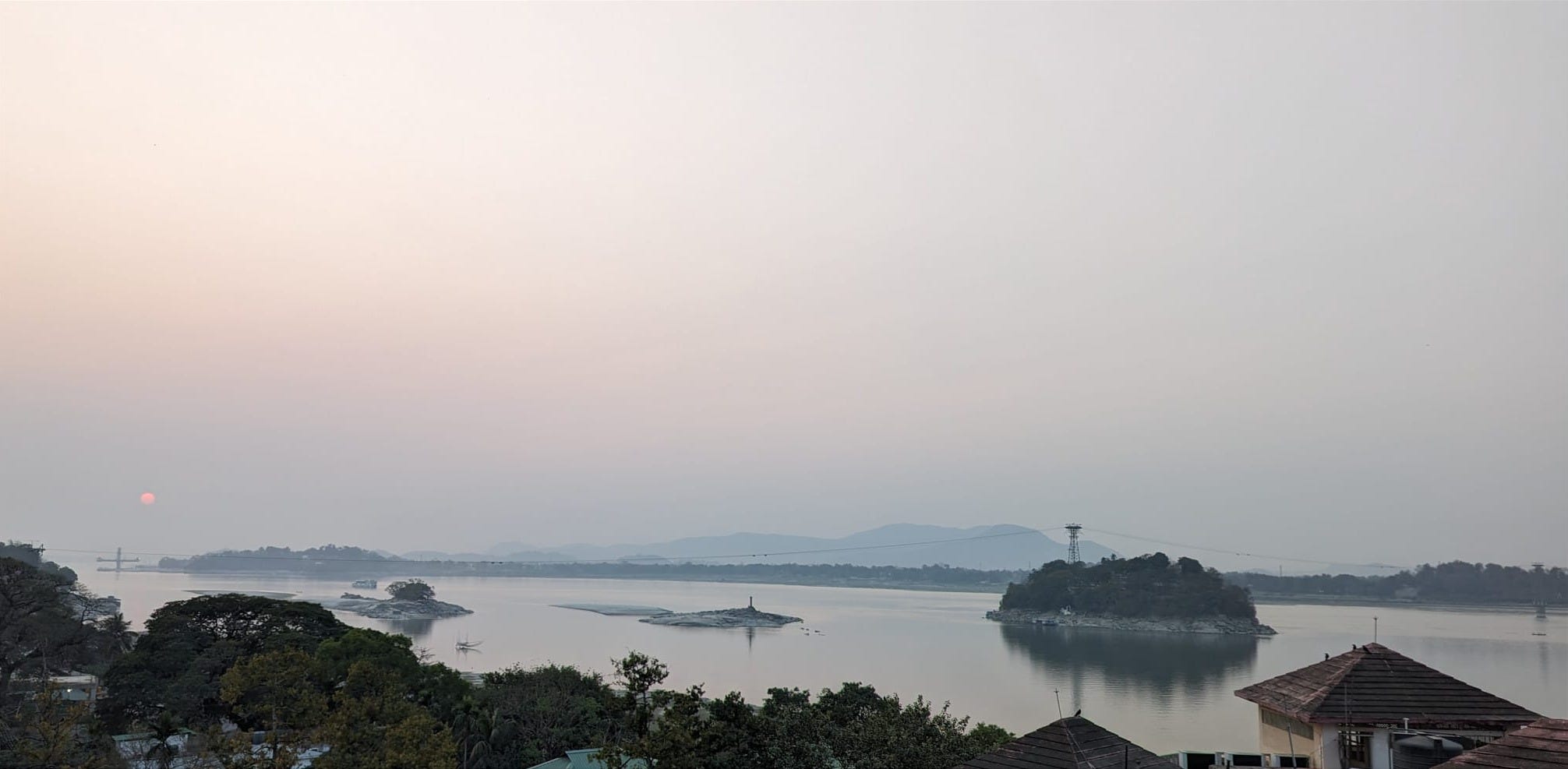
The river that shapes and shifts
Every time we crossed the Brahmaputra, my father would ask us to say a little hymn. Just a soft, whispered gesture as a moment of acknowledgment, nothing elaborate. As a child, it felt a bit silly. The river was just... there. Vast, silent, steady. Why think about it?
But looking back, it seems like I see the point better now. That small ritual wasn’t about superstition. It was about respect. A recognition that the river wasn’t simply water cutting across land. It was a presence, a force of nature. Something not to be taken for granted.
People have always romanticized their rivers, awa in Te Reo Māori, where it is part of their spiritual being. I feel something similar to my awa Brahmaputra, too. It has always been more than a waterway. It shapes my city, carries our monsoons, carries the history of wars, and forms memories.
As I grew older, my imagination of how vast the river is changed, and I realized that a lifetime is not enough to know all about the river. Growing up, I had a fragmented idea of the river. I only knew the stretch near our home. But when we traveled to my grandparents' village, some 120 kilometers away, there it was again. Wider, quieter, but familiar. And then it seems like the river still flows beside us everywhere we go. I still didn’t grasp how far it reached, until I saw it on a map, threading through mountains, slipping across national borders. No wonder it is one of the largest river systems in the world in terms of the water it discharges1. Yet the maps never quite capture what it does to people, how it becomes part of their lives, explicitly and implicitly.
The paradox that floods and feeds
The Brahmaputra is a paradox, though. As much as it enriches and feeds millions, it floods almost every monsoon, displacing homes and families. Although it sustains a web of life that stretches beyond species, borders, and generations, every monsoon turns unpredictable and wild. The same waters that bring abundance also carry grief.
With increasing glacial melt feeding its waters and shifting monsoon patterns, the flooding of the Brahmaputra is becoming no less challenging; if anything, it’s becoming more complex. The situation is further intensified by large dams being planned upstream, often across borders, without meaningful transboundary dialogue or the inclusion of downstream communities. The broader implications of such decisions—political, ecological, and ethical—deserve deeper exploration, perhaps in another essay. But here, I want to dwell on the particular tension at the heart of the Brahmaputra paradox.
Can or should we control the river flow?
For decades, the dominant response has been to engineer control through embankments, levees, and dams. Yet, the persistence of the problem suggests that these methods are either ineffective or that the very idea of controlling a river like the Brahmaputra is, at best, an illusion.
This persistence is not accidental; it’s what researchers have described as a form of technological lock-in2. Embankments became the dominant flood solution not merely because of their merit, but because they aligned with political expediency, engineering norms, and the urgency of post-disaster reconstruction. The 1954 floods triggered the institutionalization of embankment building exercises and the deployment of national engineering agencies. This pivotal moment marked the beginning of flood risk management being viewed from a narrow, control-focused lens. And this orthodoxy in problem solving persisted.
The illusion of control is further complicated by how we’ve come to understand the river itself. A recent reconstruction of Brahmaputra River discharge using an advanced scientific method going back nearly 700 years reveals a striking truth: the modern instrumental record (1956–1986), on which most of our flood management policy relies, is among the driest periods in the last seven centuries¹. According to the study, flood-level discharges that current planners consider once-in-five-year events may have historically occurred every 2–3 years, and climate projections suggest these could become near-biennial by the end of the century. This means our assumptions about how frequently the river floods, let alone how severely, are deeply flawed.
Technological advancements now allow us to peer into centuries of the river’s behavior, offering glimpses of the past that can guide future planning. However, data and models alone are not enough. They may help us anticipate floods, but they cannot, on their own, ease the pain, the disruption, and the displacement that riverine communities endure year after year. Nor can they fully capture the cascading effects on society, the economy, or the capacity of governments to respond. Knowing more and understanding risk must be the first step, not the solution.
When controls don’t work
The Brahmaputra no longer behaves like the river these systems were designed to hold back. In the flood-prone districts of Upper Assam, particularly Dhemaji and Lakhimpur, post-flood land degradation is increasingly characterized by the phenomenon of sand casting, wherein high-energy floodwaters deposit coarse sediment layers over fertile agricultural fields. Unlike fine alluvial silt that enhances soil fertility, sand casting results in long-term soil infertility, resulting in large areas of land unsuitable for cultivation. This process is frequently associated with embankment breaches and channel avulsions, and constitutes a significant secondary impact of structural flood control measures in the Brahmaputra basin3. The cumulative effect of recurrent sand deposition exacerbates livelihood insecurity within riverine communities.
The 2012 floods in Barpeta district are one of the many instances that serve as reminders. Three waves of flood submerged nearly the entire district, affecting 686 villages and displacing over 80,000 people4. More than 12,000 homes were destroyed. The administrative response was intense: 292 boats were deployed, 40 medical teams formed, and 105 relief camps established. Rescue operations were backed by round-the-clock emergency coordination and early warning dissemination to village-level officials. Despite these efforts, the suffering was immense, and recovery was slow.
Layers of risk call for nuanced mitigations
Such complex and resource-intensive responses reveal just how burdensome post-flood recovery can be. A deeper understanding of flood risk and its drivers, grounded in the river’s specific hydrological behavior, the social vulnerability of flood-affected communities, and the governance structures that shape response, is essential. When conversations around risk mitigation integrate classrooms, laboratories, government offices, and paddy fields, more holistic and context-specific approaches can emerge.
Such an approach to risk reduction must center on the well-being of the communities that live alongside the river, often absorbing the worst of its fury. Engineered solutions still have a role: early warning systems, river monitoring networks, and flood zoning can offer critical lead time and guidance for effective preparation. Financial innovations, such as parametric, anticipatory insurance, can provide immediate resources to households when the waters rise, offering a buffer against crisis and desperation.
At the same time, community preparedness is indispensable. In many parts of Assam, local adaptation has long included chang-ghars, stilt houses raised above flood lines, seasonal migration, and the use of ancestral cues to guide planting and evacuation. These are not just coping mechanisms; they are embedded systems of knowledge developed over generations. Recent field research5 from Dhemaji and upper Assam confirms this: elevated granaries, early-sown crops, and localized flood mapping have helped communities coexist with floods far more sustainably than most externally imposed systems4.
Urban and rural development, too, must evolve. Zoning regulations that restrict construction in flood-prone areas aren’t just restrictions but acts of responsibility and foresight. Each building in a vulnerable zone adds not just personal risk, but social risk that a future generation has to bear.
A Mosaic of Care, Not Control
To move forward, we must adopt a more layered approach that combines structural measures with flexible, adaptive, and community-centered solutions.
Investments in wetland restoration, riparian buffers, and nature-based solutions are not just environmentally sound; they offer flood absorption and protect livelihoods6. Alongside better forecasting and infrastructure, these strategies form a layered defense: a mosaic of care that stretches from policy offices to paddy fields.
In the end, perhaps adaptation is our only real path to coexistence, not just with the Brahmaputra, but with rivers everywhere. These forces of nature were never meant to be subdued. Like people, rivers resist domination. What they may demand instead is reverence and a willingness to understand their flows and rhythms. Not to master the river, but to belong with it.
Thank you for reading this essay and joining me on this journey of exploration. If you found it interesting and valuable, I would be grateful if you could share it with just ONE friend or colleague who may also find it intriguing. Also, please feel free to share your thoughts; what made you ponder for a second longer than usual?
Rao, M. P., Cook, E. R., Cook, B. I., Palmer, J. G., D’Arrigo, R. D., Krusic, P. J., ... & Singh, J. (2020). Seven centuries of reconstructed Brahmaputra River discharge demonstrate underestimated high discharge and flood hazard frequency. Nature Communications, 11, Article 5307.
Wasson, R., Saikia, A., Bansal, P., & Joon, C. C. (2020). Flood mitigation, climate change adaptation and technological lock-in in Assam. Ecology, Economy and Society-the INSEE Journal, 3(2), 083-104.
Borah, L., Kalita, B., Boro, P., Kulnu, A. S., & Hazarika, N. (2022). Climate change impacts on socio-hydrological spaces of the Brahmaputra floodplain in Assam, Northeast India: A review. Frontiers in Water, 4, 913840.
Pal, I., Singh, S., & Walia, A. (2013). Flood management in Assam, India: A review of Brahmaputra floods, 2012. International Journal of Scientific and Research Publications, 3(10), 1–7.
Hazarika, N., Tayeng, T., & Das, A. K. (2016). Living in troubled waters: stakeholders’ perception, susceptibility and adaptations to flooding in the Upper Brahmaputra plain. Natural Hazards, 83, 1157-1176.
Sinha VR, Bimson K (eds.) (2021) Nature-based Solutions in the Ganges Brahmaputra Meghna (GBM) river basin: Case studies and lessons learned. Bangkok, Thailand: IUCN ARO. viii + 69pp
An amazing story about our mighty river Brahmaputra. Your fascination about the mysterious river can be fathomed from the story. Keep it going 👍